
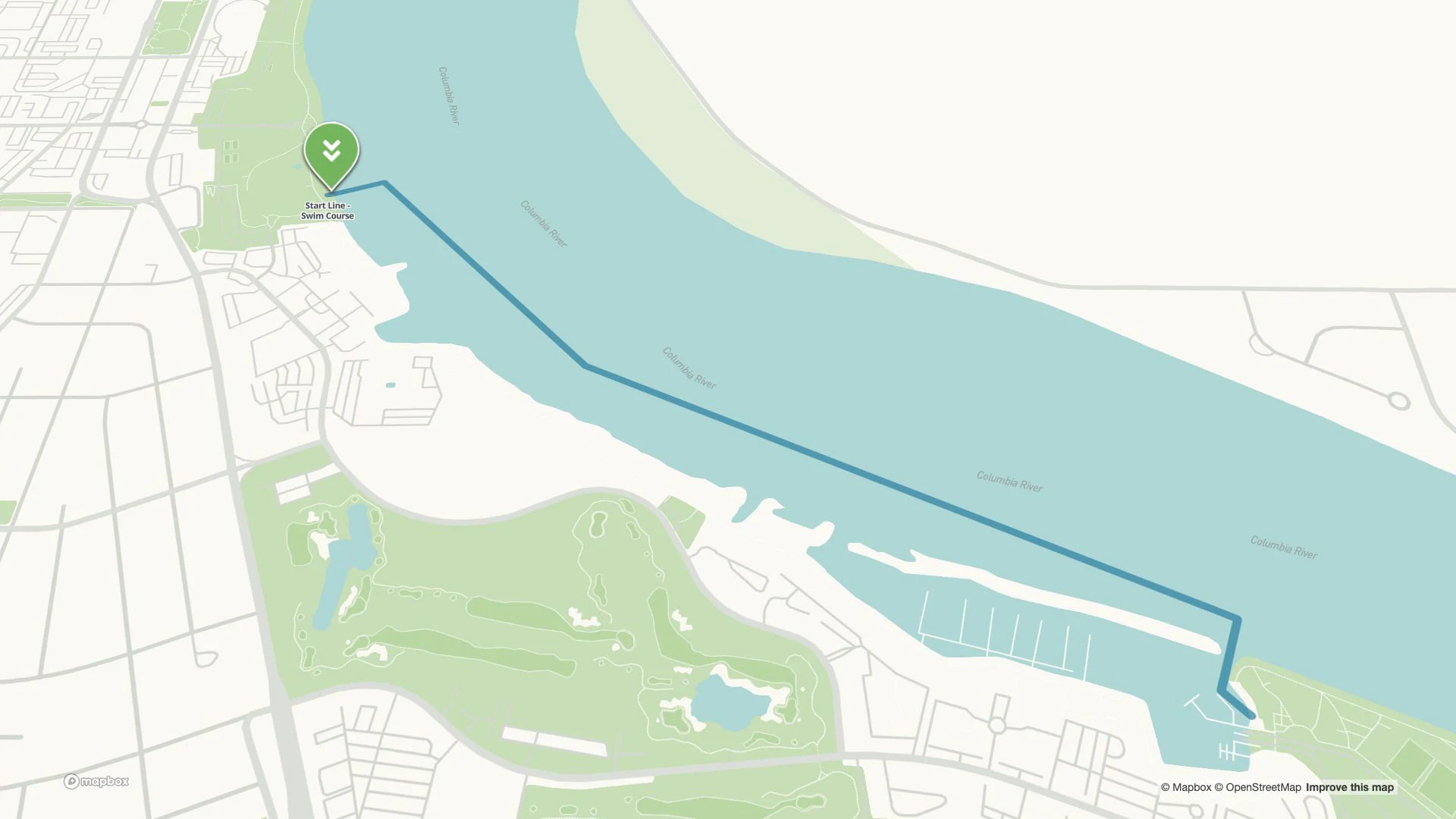
1.2mile swim
Swim the Columbia
The start, the river and the way out. Bring the swim course and its arrival places into one view.
Explore the course: Swim (opens in a new tab)Event maps for destinations
The course. The crowd. The place to park. Help everyone picture their day, from the first arrival to the finish-line celebration.
More than the main event
Athletes want to know the route. Families want to know where to cheer. Everyone needs a way to arrive, find their people and enjoy the place they came to visit.
Wander brings those pieces together. Put your event’s courses, venues and visitor essentials on the same map, then connect the weekend to the rest of your destination.
Explore the swim, bike and run. Zoom into transition, find parking and follow the connections to aid stations and riverfront facilities.
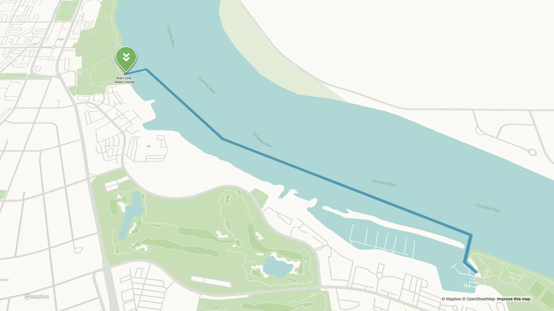
Follow the course
Follow the swim course downstream, from the start beside Howard Amon Park to the exit near Columbia Point. See the start, finish and nearby facilities in one view.
Explore Tri-Cities’ existing event map. For your race weekend, check the organizer’s current course and visitor guide (opens in a new tab).
See the shape of the day
1.2mile swim
The start, the river and the way out. Bring the swim course and its arrival places into one view.
Explore the course: Swim (opens in a new tab)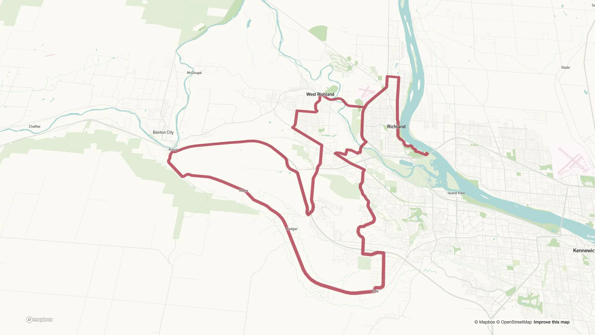
56mile bike
Let athletes explore the course through Richland and the countryside, with aid stations connected to the route.
Explore the course: Bike (opens in a new tab)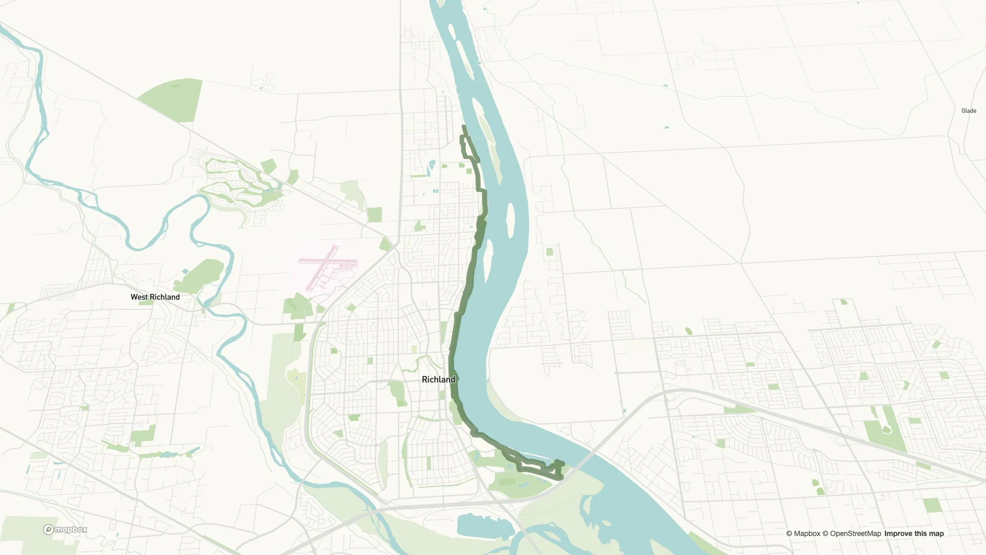
13.1mile run
Trace the riverfront run, find the finish and help supporters picture where they fit into the day.
Explore the course: Run (opens in a new tab)Event distances: Visit Tri-Cities (opens in a new tab). Map imagery: Wander · © Mapbox © OpenStreetMap.
Build around your event
Draw courses on the actual landscape. Let people move from the full route to an individual turn, transition or support stop.
Explore this feature: Make the route tangibleLink a venue or transition area to its parking, transit stops and entrances. Put the practical choices beside the place people are trying to reach.
Explore this feature: Connect the arrivalBring viewing places, restrooms and gathering spots together. Add the local advice that helps families enjoy the day too.
Explore this feature: Give supporters a planConnect the race with community celebrations, local food, shops and places to stay. Give visitors a reason to arrive early and stay longer.
Explore this feature: Build a whole weekendEmbed the same map beside your event pages. Focus each page on its course, venue or visitor places while keeping the wider destination close by.
Explore this feature: Keep the map in the storyLink signs, visitor guides and printed programs to the map with QR codes. Help people return to the right information throughout the event.
Explore this feature: Take it beyond the websiteYour event, your map
No. Build around the way your event uses places: a downtown festival, arts weekend, campus event or regional celebration. Connect venues, entrances, parking and nearby discoveries on the same map.
Yes. Bring your course data and the locations your team already maintains. We help turn them into routes and places on your event map.
Yes. Link places such as parking, transit stops and restrooms to the venue or route they serve, so visitors can discover the practical details together.
Yes. Your team can update places, descriptions and routes in Wander. Keep reusable destination information and revise the details that change for each edition.
Bring the courses, the venues and the local knowledge. We’ll build the experience with you.
Book a demo