Build your map

The map builder

Build the definitive, interactive map of your destination.

Your destination as a living, interactive map — beautiful, official, stewarded by you, in the pocket of travelers who already explore on Wander. We do the white-glove build: your trails, your places, your systems, wired together and kept current. It never lands on your desk.

Everything it does

The most capable destination map builder there is.

Most map tools give you pins on a basemap. Wander gives you a full authoring studio — brand, geography, rich place data, guided experiences, data sync, team controls, and analytics. Here's what's inside — all of it set up for you in the white-glove build.

Your map, your brand

Every map is unmistakably yours — down to the basemap.

  • Choose a Wander basemap, bring your own custom Mapbox style, or design one with terrain and sky layers
  • Your cover and header logos, plus primary and contrast brand colors throughout
  • Draw your destination boundary and shade everything outside it to keep the focus on you
  • Set the perfect opening view with default pitch, bearing, and zoom, and a custom URL for your map

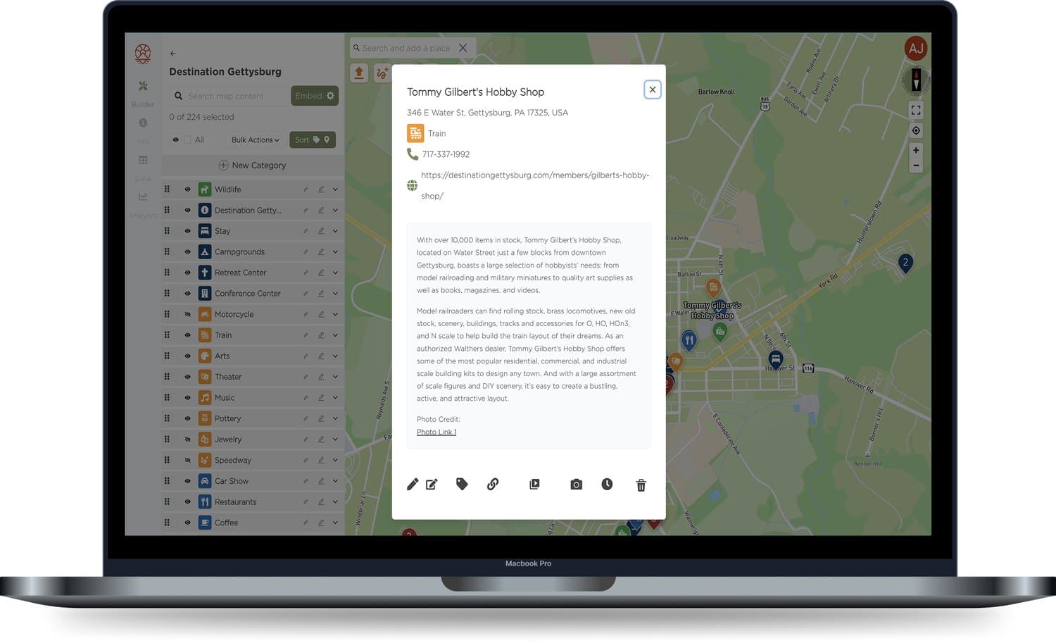
Every place, richly detailed

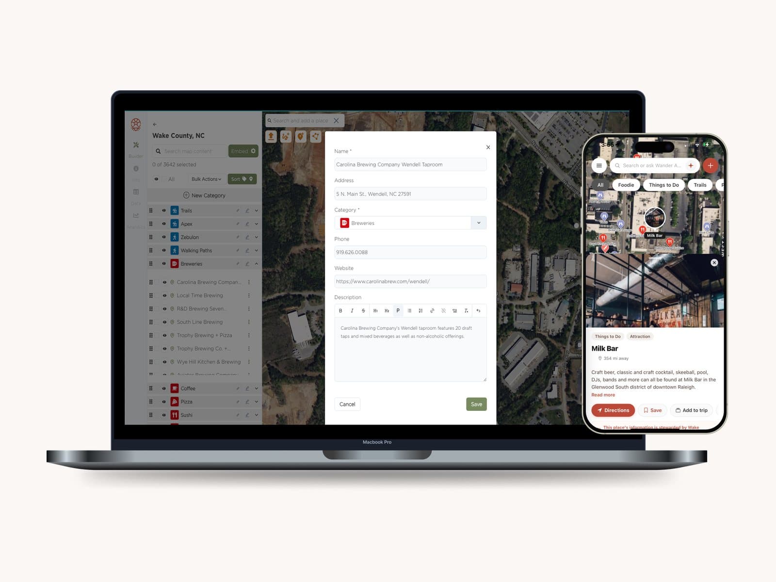
Add places in seconds and give each one real depth.

  • Drop a pin, search Google Places, or import — then edit right on the map
  • Hours (with Google import, bulk editing, and overrides), phone, website, address, and description
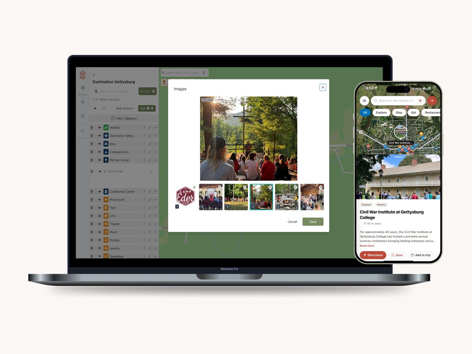
  • Up to six photos, video highlight reels, and galleries on every place
  • Foursquare enrichment to auto-fill details and imagery, plus custom fields for pricing, accessibility, and anything else

Trails, routes & regions — not just pins

The only builder where lines, shapes, and pins live together.

  • Draw trails and routes with distance, elevation gain, and start-and-end markers
  • Fly-through pitch and bearing, in-place geometry editing, and bulk trail merging
  • Draw polygons for neighborhoods, districts, park boundaries, and regions visitors can tap into
  • Indoor mapping with buildings and floors when you need it

Organize how visitors explore

Total control over categories, filters, and the map's logic.

  • Categories with full styling — icons, colors, clustering, labels, and zoom rules
  • Custom, hierarchical tags and filters for amenities, price, accessibility, and more
  • Order tags alphabetically, by popularity, or exactly how you want
  • Turn on hours filters and let visitors submit place suggestions

Guides, tours, itineraries & challenges

Go beyond the map with curated, guided experiences.

  • Build guides and self-guided tours from your places
  • Feature and verify visitor-made lists onto your official map
  • Link related places with labels and set navigational targets
  • Run check-in challenges with geofenced radius, photo requirements, rewards, and date windows

Bring in your data — and let AI help

Start from what you already have; keep it in sync.

  • Import KML and GeoJSON with field mapping and validation
  • Import from a URL, blog, or social post with AI-assisted place creation
  • Sync from Simpleview, WordPress, and Wild Apricot with dry-run previews and diff reports
  • Bulk edit, tag, and delete, or export your entire dataset anytime

One source of truth, everywhere

Curate once — publish to every channel at once.

  • Everything flows to your Wander app presence, website embeds, and share links
  • Publish and unpublish with a click; nothing to keep in sync by hand
  • Stage different versions with per-version place visibility before you go live
  • Full-map, itinerary, and simple embeds, plus shareable deep links to any place

Built for teams & partners

Bring your whole organization — and credit the locals.

  • Invite your organization with per-map permission levels you control
  • Role-based access so no one can grant more than they have
  • Credit map stewards — DMOs, government, community, sponsors, and media
  • Custom “Curated by,” “Sponsored by,” and “As seen in” labels with partner logos

See what's working

First-party analytics on your own map, built in.

  • Most-viewed places and categories, and what visitors search for most
  • Map loads over time, top visitor locations, and referring sites
  • Filter by time frame, iOS vs. Android, and visitor type
  • Plus check-in data from challenges and full data export

We build it with you

White-glove setup: we gather your trails, POIs, and open data, connect your systems, and keep it current. It never becomes another chore.

Stewarded by you

Your brand, your basemap, your curation — the official map visitors trust because they can see who keeps it.

One source of truth

Change it once and it flows to your app, your website, and every embed. Nothing to keep in sync by hand.

Proof you own

First-party data you own — visitors guided to your local businesses, in a plain-English report you can take to the board.

A closer look

See it in action.

Add and edit places right on the map — drop a pin, search, or import.

Give every place photos and video — up to six images plus highlight reels.

More in build your map

See the map builder in a demo.

Book a 20-minute demo and we'll show you the map builder on a destination like yours.

Book a demo

The world is bigger than your feed.

Turn reels, links, and friends' recommendations into real trips
— on official maps that work offline. Free.