Build your map

Polygons & areas

Draw regions, districts, and boundaries as interactive shapes.

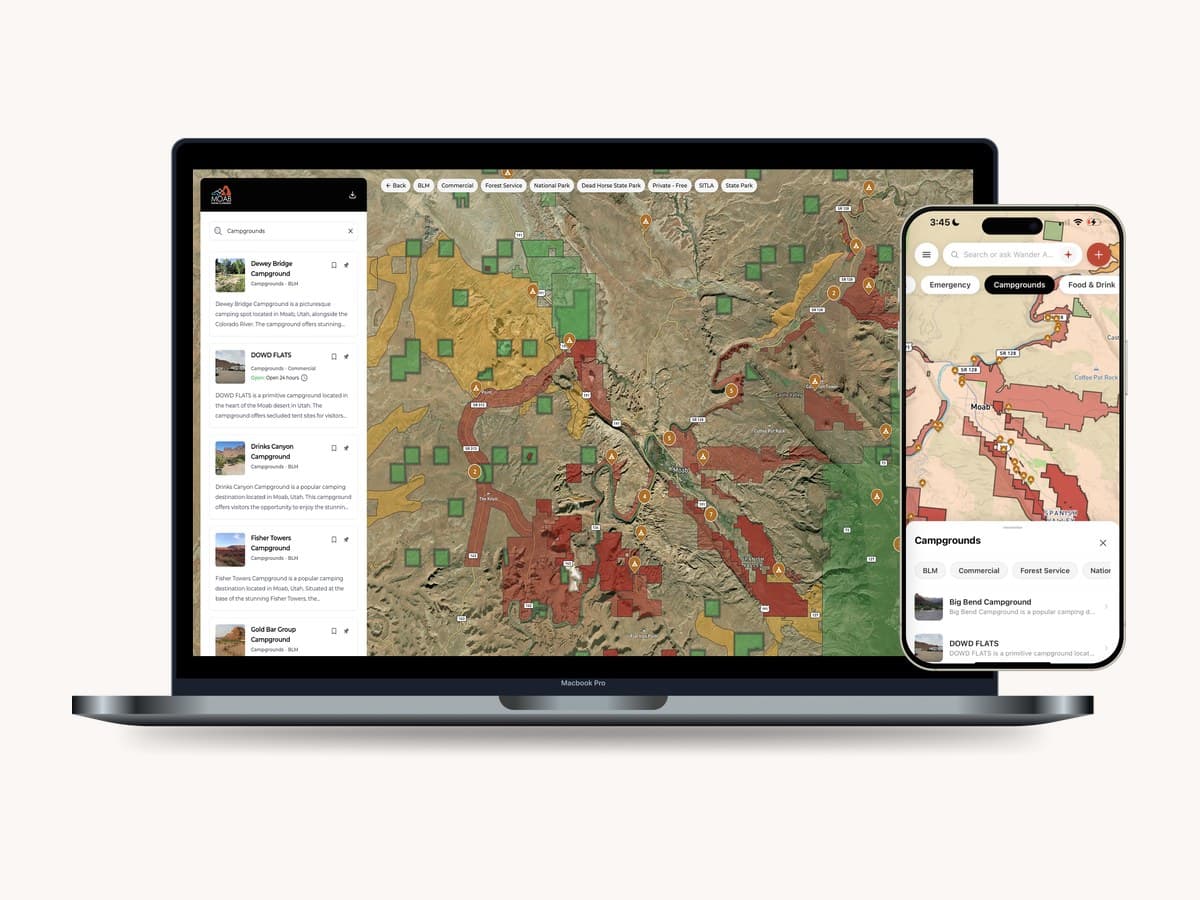
Some places are areas, not pins — a district, a park, a wine region. We draw them as interactive shapes visitors can tap into, styled to your map. You get finished areas; we do the drawing.

Book a demo

How you’ll use it

  1. 1.Tell us the districts, parks, and regions that matter; we draw them as styled, interactive shapes.
  2. 2.Visitors tap an area to see what it is and what's inside it.

Why it matters

Areas give visitors the mental map of your destination — which district is walkable, where the wine region begins — context that pins alone can't carry.

Everything it does

Some places are areas, not points.

A neighborhood, a district, a park, a wine region — these aren't pins. Wander lets you draw them as real, interactive shapes visitors can see and tap into.

Draw any area

From a single district to a whole region.

  • Simple or complex shapes, including areas made of multiple parts
  • Neighborhoods, districts, park and trail boundaries, zones, and regions
  • Draw right on the map or paste in coordinates you already have

Styled to match your map

Areas look like part of your brand, not a generic overlay.

  • Fill color, opacity, and pattern control
  • Outline styling and area labels
  • Per-category styling so different area types read differently

Interactive, not decorative

Every area is a place visitors can explore.

  • Tap an area to open its name, description, photos, and hours
  • Link an area to the places inside it
  • Combine polygons with pins and trails on one map

Define your destination's edges

Draw your boundary and keep the focus on you.

  • Draw your official destination boundary
  • Shade everything outside it to frame your area
  • Set the default view so visitors land exactly where you want

We draw them for you

Neighborhoods, districts, park boundaries, and regions — drawn and styled as part of your build.

Interactive, not static

Visitors tap into an area to see what's inside — the places you steward there.

A closer look

See it in action.

Discover Moab's districts and land areas drawn as interactive shapes — on desktop and mobile.

More in build your map

See polygons & areas in a demo.

Book a 20-minute demo and we'll show you polygons & areas on a destination like yours.

Book a demo

The world is bigger than your feed.

Turn reels, links, and friends' recommendations into real trips
— on official maps that work offline. Free.

© 2026 Wander App Inc. All rights reserved.