
Fishing maps for tourism boards

Fishing maps that draw the rules on the water

One creek can carry several sets of rules. Draw each one on the water, then put access, flow and the local places that complete a fishing trip beside it.

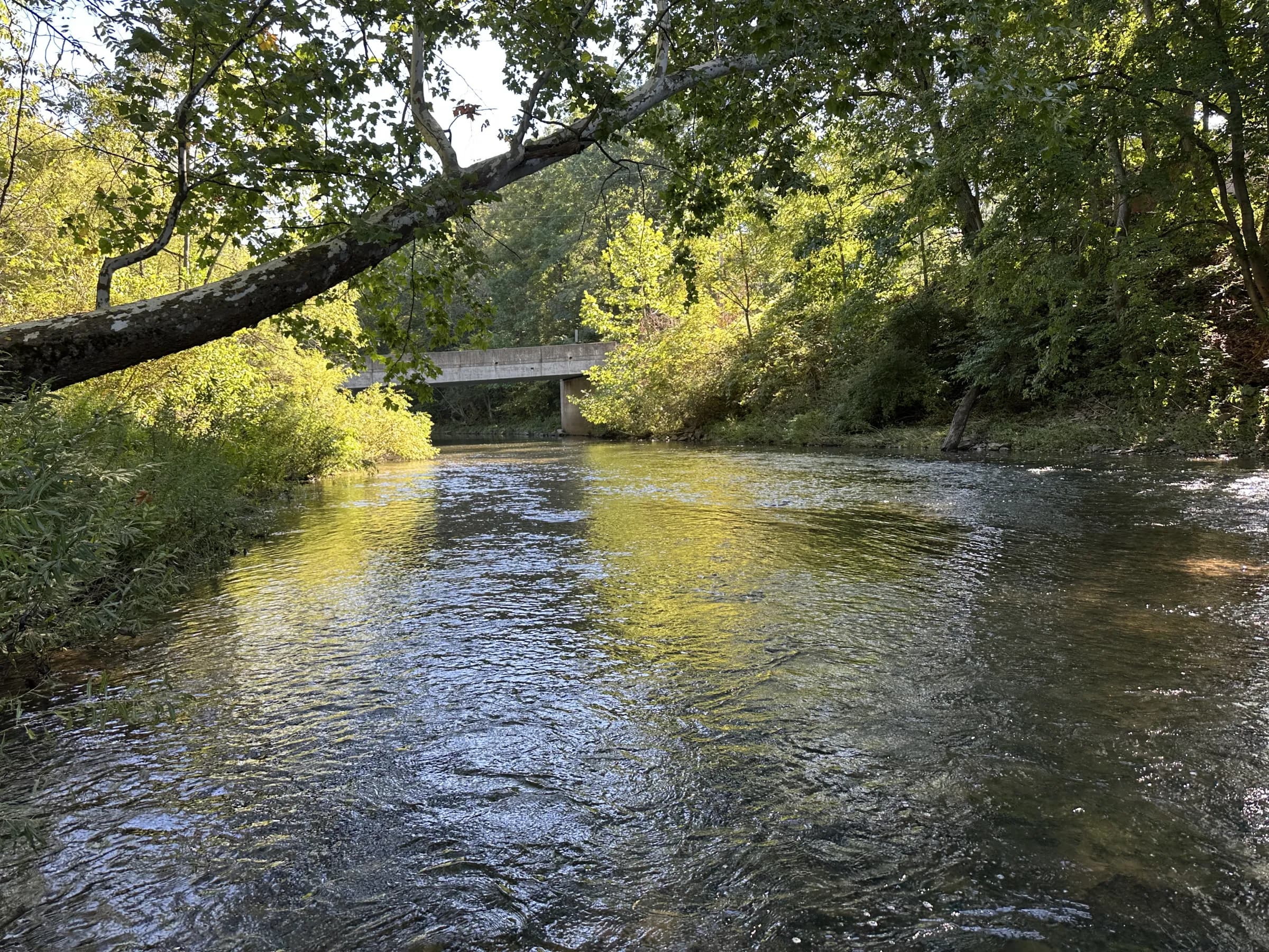
Bald Eagle Creek flowing toward the Julian bridge in Pennsylvania
Bald Eagle Creek at the Julian bridge, inside the stocked-trout stretch.

Answer first

What makes a useful fishing map?

A fishing map for a destination shows where anglers can legally fish and the rule on each stretch, beside parking, fly shops and places to stay. Wander builds it into the destination’s official map from credited public data.

On Bald Eagle Creek in Centre County, Pennsylvania—not the creek at Tyrone—stocked water, a short All-Tackle Keystone Select stretch and Class A wild-trout water sit on the same line.

The example comes from Explore Julian, built by Wander as a reference destination, not a paying customer. Wander publishes public, official information and dates every regulation check.

See the live fishing guide on Explore Julian, built by Wander as a reference destination (opens in a new tab)

Real creek geometry · illustrative colors

Bald Eagle Creek, stretch by stretch.

Tap a badge or a stretch to move to its dated rule card. The picture, labels and full rules are server-rendered and remain complete without JavaScript and under reduced motion.

Choose a regulation stretch
Bald Eagle Creek fishing regulations, access, parking and fly shopsA static, labeled picture of Bald Eagle Creek in Centre County, Pennsylvania. Stocked Trout Waters, the overlapping All-Tackle Keystone Select stretch and Class A wild trout water are drawn in different colors and keyed to the regulation cards below.Soaring Eagle parkingPJulian bridge accessATCO Fly ShopSFlyfisher’s ParadiseSMilesburg confluenceA02–050406KEYSTONE SELECT INSET04about 0.8 mile · all tackle
Illustration from Bald Eagle Creek sections in Wander’s live map data. Distinct colors are used for this illustration; the live web map currently draws all three with one regulation color.A accessP parkingS fly shop
02–05

22.98 miles

Stocked Trout Waters

Bell Hollow Road bridge above Port Matilda to the Spring Creek confluence at Milesburg, with the Keystone Select stretch inside it.

On October 1, 2026, extended-season rules apply: three trout a day, each at least 7 inches. In 2026, the regular season ran April 4 at 8:00 a.m. through September 7 with a five-trout limit and 7-inch minimum; the extended season runs January 1–February 15 and September 8–December 31.

Source: Pennsylvania Fish and Boat Commission, 2026 Pennsylvania Fishing Summary, pages 10 and 32. Checked October 1, 2026.

Check current PFBC regulations (opens in a new tab)
04

about 0.8 mile

All-Tackle Keystone Select

From 0.38 mile above to 0.48 mile below Steel Hollow Run at Soaring Eagle Wetland.

Open year-round; all tackle types are permitted. From June 15 through Labor Day, the limit is three trout a day at 9 inches or longer. From the day after Labor Day through June 14, no trout may be killed or possessed.

Source: Pennsylvania Fish and Boat Commission, 2026 Pennsylvania Fishing Summary, page 16. Checked October 1, 2026.

Check current PFBC regulations (opens in a new tab)
06

5.72 miles

Class A wild trout

Spring Creek confluence at Milesburg to the inlet of Sayers Lake near the Boggs–Howard Township line.

All tackle types are permitted. Brown trout are catch-and-release at all times. Other trout had a 7-inch minimum and five-trout limit from the 2026 opener through Labor Day, then catch-and-release through the third Sunday in February. The stretch closes to all fishing from the third Monday in February until the statewide opener. On October 1, 2026, all trout are catch-and-release.

Source: Pennsylvania Fish and Boat Commission, 2026 Pennsylvania Fishing Summary, page 16. Checked October 1, 2026.

Check current PFBC regulations (opens in a new tab)

Regulation limits and stream line: Pennsylvania Fish and Boat Commission GIS data, modified by Wander. Limits were snapped to the Wander line, and PFBC sections 02, 03 and 05 are shown as one stocked stretch. Not a legal document or approved by PFBC. Checked against the 2026 Pennsylvania Fishing Summary on October 1, 2026. Check current PFBC regulations before you fish. Data gate: 2026-10-01–2026-12-31.

What anglers need

Seven layers. An honest status on every one.

The best map joins rules and trip planning without pretending an illustration is already a shipped feature.

  1. Regulation stretches

    Live data · web map

    Named sections and shareable links are live on the Wander web map for Explore Julian, built by Wander as a reference destination. The distinct colors on this page are an illustration; the live creek sections use one regulation color, and the overlay is not yet in website embeds or the app.

  2. Public access and parking

    Mapped · field visit pending

    Access and parking are mapped from PFBC sources and on-the-map checks. The legal status should travel with every pin; roadside access on private land is not the same as a public fishing easement.

  3. Live flow

    Live on the reference site

    Explore Julian, built by Wander as a reference destination, places USGS streamflow beside the fishing guide. This page uses a dated snapshot, and the Milesburg gauge includes Spring Creek, so it reads higher than the water at Julian.

  4. Stocked this week

    Illustration · not a live Wander feed

    The useful framing is “stocked this week—here is where to spread out,” using dated PFBC records. Wander does not currently ingest the PFBC stocking schedule or send stocking-morning alerts.

  5. Map downloads

    Available in the app

    Visitors can download a map before they head to the water on iPhone and Android. Smart pre-download is currently an iPhone feature that Wander switches on for selected maps.

  6. Fly shops and guides

    Shops live · no guide listings here

    Local fly shops can appear with their hours beside the water. Two shop listings are live on this reference map; no guide listings are currently published for it.

  7. Itineraries

    Capability live · example not published

    A destination can build a fishing day or trail from its mapped places. Wander itineraries are live, but Explore Julian, built by Wander as a reference destination, does not currently publish a fishing itinerary.

Dated flow snapshot

Milesburg: 321 cfs versus a normal 174.

Read at 10:00 a.m. EDT on October 1, 2026. The gauge is below the Spring Creek confluence, so it reads higher than the water near Julian. This is a provisional snapshot, not a live value.

Bald Eagle Creek below Spring Creek

321 cfs

Normal for the date · 174 cfsSnapshot · 321 cfs

Streamflow data courtesy of the U.S. Geological Survey. Provisional data, subject to revision.

For tourism boards

Turn a pin map into a reason to stay.

Most destination fishing pages we reviewed are short lists of pins with brochure copy: no rules, stocking or conditions. The opportunity is to connect the water to the trip around it.

Book a demo

The gap today

State agencies publish authoritative regulation layers, often through clunky agency tools. TroutRoutes, now part of onX, includes fishing regulations in a paid plan. The destination pages we reviewed show pins, not rules drawn on each stretch.

A trail can shape demand

In 2013, Jackson County, North Carolina Tourism said that from September to early spring, 20–30% of its inquiries were about fishing, mostly about its Fly Fishing Trail. A Sylva fly shop opened in response to the trail.

Industry example, not a Wander result or customer.

Carolina Sportsman, 2013 (opens in a new tab)

For travelers

Plan on the page. Keep the trip in Wander.

Save places, build a trip and get directions in the Wander app. Download the map before you head to the water so the mapped places, guides and trips remain useful when the signal drops. Regulation-stretch display is not currently live in the app.

Fishing map FAQ

Questions a destination should ask first.

What is a fishing map for a destination?

A fishing map for a destination shows anglers where they can legally fish and what the rules are on each stretch of water, beside parking, local fly shops and places to stay. Wander builds it into the destination’s official map from credited public data.

What should a destination fishing map include?

Seven useful layers: rules on each stretch, public access and parking with legal status stated, current river conditions, dated stocking records, a map visitors can download, local fly shops and guides, and suggested trips.

Can one creek show different regulations on different stretches?

Yes. A Wander map can hold named stretches along one stream, each with its own regulation and badge. Bald Eagle Creek’s sections are live in the web map data and list for Explore Julian, built by Wander as a reference destination. The distinct colors shown here are illustrative; the website-embed and app overlays are not live.

Where does the fishing data come from?

From the agencies that publish it: the Pennsylvania Fish and Boat Commission for stream sections, regulations and stocking records; the U.S. Geological Survey for streamflow; the National Weather Service for forecasts; and the U.S. Army Corps of Engineers for Sayers Lake data. Each source is credited where its data appears.

Do you publish anglers’ private spots?

No. Wander fishing maps are built around public, official information: agency regulations, access with its legal status stated and dated stocking records. They do not publish crowdsourced private spots or send live stocking-morning alerts.

Can visitors use the map without cell service?

Yes. In the Wander app on iPhone and Android, visitors can download the map before they head to the water. The app also keeps saved places, guides and trips together on the map.

Can we put a fishing map on our website?

A destination’s official Wander map can embed on its website. The regulation-stretch overlay illustrated on this page is not currently available in website embeds, so the rules should also remain in server-rendered text.

Is Explore Julian a Wander customer?

No. Explore Julian was built by Wander as a reference destination to show what a destination website built on a Wander map can do.

Sources stay with the map.

Regulations and section limits are credited to the Pennsylvania Fish and Boat Commission. Streamflow is credited to the U.S. Geological Survey; forecasts to the National Weather Service; and Sayers Lake data, when shown, to the U.S. Army Corps of Engineers, Baltimore District. The regulation geometry shown here was modified as described beneath the creek map.